


Famous for its food, bright lights and popular tourist spots like its Castle and Universal Studios, Osaka isn’t the first place that comes to mind for nature and hiking. But this small prefecture is in fact surrounded on three sides by mountains, woodland and rural communities.
Much of the southern and eastern edges of Osaka Prefecture are within the Kongo-Ikoma-Kisen Quasi National Park. This park includes three mountain ranges, the Kongo Range, the Ikoma Range and the Izumi Range. None of the mountains within these ranges are particularly difficult to climb and several are also quite accessible from downtown Osaka making them ideal day trips.
There is even a dedicated hiking trail known as the Diamond Trail which is (mostly) well signposted and connects a number of mountains together. It starts from a mountain temple Sefuku-ji on Makio-san in southern Osaka and finishes at Nijo-san on the Osaka/Nara border.
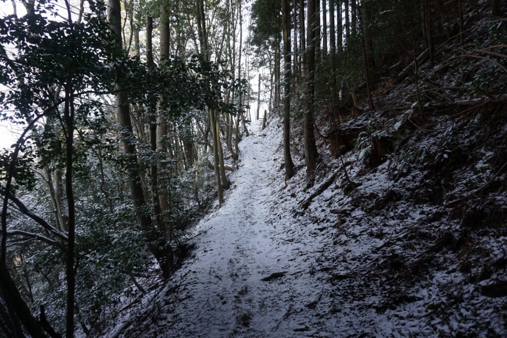
Two mountains in particular, Mount Kongo in the village of Chihaya-Akasaka and Mount Iwawaki in the city of Kawachinagano are especially popular hiking destinations all year round. Kongo-san especially is easy to reach by public transport and both mountains are relatively easy climbs while also being good places to experience snow in late January and February. However, I do strongly advise getting some ice cleats if you are planning to hike in winter because the paths can become quite icy.
Table of Contents
Mount Kongo
Kongo-san is considered the highest point in Osaka Prefecture, though technically not the highest mountain as its summit is actually just over the border in Nara Prefecture. It is also extremely easy to reach, a simple bus ride from either Kawachinagano Station on the Nankai Koya Line or Tondabayashi Station on the Kintetsu Minami-Osaka Line.
This mountain is important in the historical and spiritual story of Osaka and Japan as a whole; with a mysterious temple, Yamabushi pilgrimage spots and even one of Japan`s Top 100 Castles hidden upon its wooded slopes.
There are two main trails on the Osaka side of Kongo-san, both very near to bus stops. My preference is to take the bus to the final stop, “Kongo-san Ropeway”. The ropeway itself is actually no longer in service but I find the nearby trail the easier of the two to ascend.
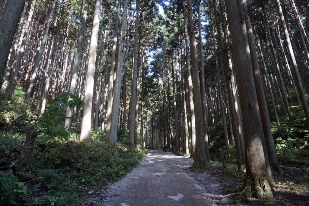
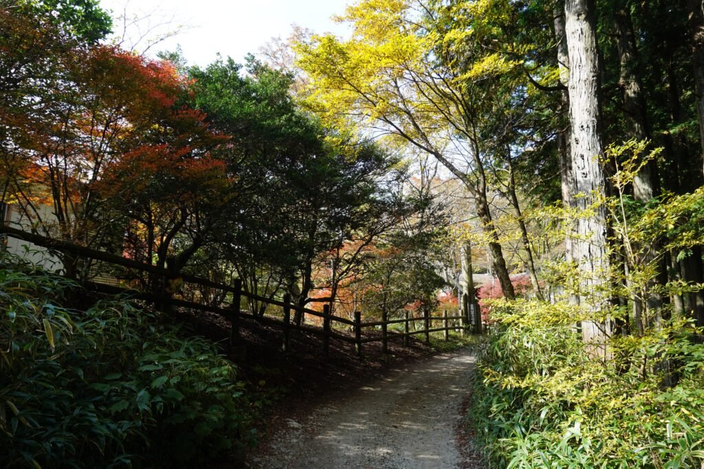
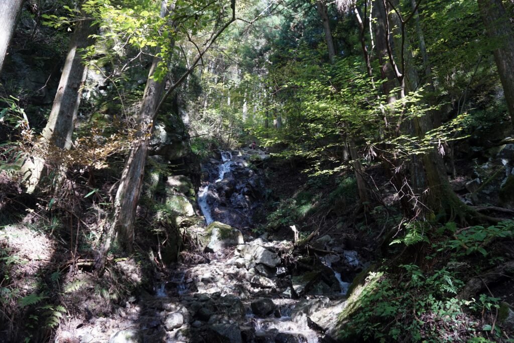
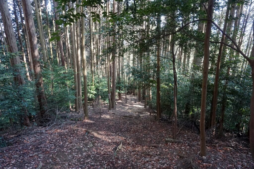
Although a little steep in places, much of this wide, easily navigable path is roughly paved as it serves as an access route for small vehicles to service various buildings near the summit. The road winds its way up the mountain, sometimes parallel to a small stream with the occasional waterfall. The canopy of tall cedar trees offer a good deal of shade making the route a little cooler and more comfortable in the summer.
Eventually the path opens out into a field and an astronomy center, though I have never visited this so cannot provide any detail. The scattering of benches and vending machine make it an ideal place to take a break before pushing back up the mountain.
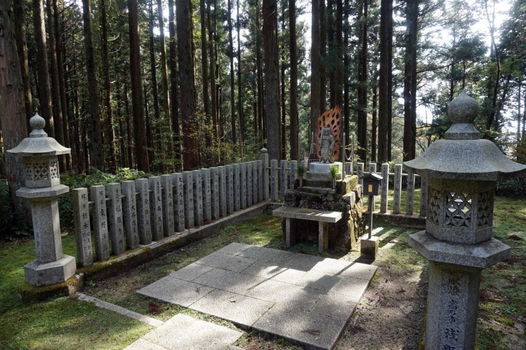
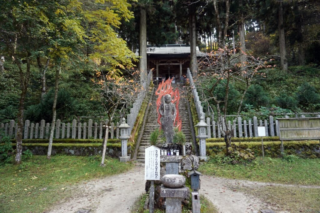
Beyond this rest area, the path narrows and the trees close in again as the ascent continues. Before long, the path opens out again slightly into a small glade. At the center of this is an altar holding a statue of the Buddhist deity O-Fudo-Myo-o-sama, easily recognized by his sword and aura of fire and hinting at the spiritual importance of the mountain. Just around the corner from the glade is a large but simple torii gate made from bare logs.
Passing under the torii and continuing further along the path, stone pillars bearing the names of people who have made donations to the nearby shrine of Katsuragi jinja. The path here splits in two with one leading up some steps into the shrine and the other passing around its perimeter. Both routes lead to Tenporin-ji, an ancient and mysterious mountain top temple.
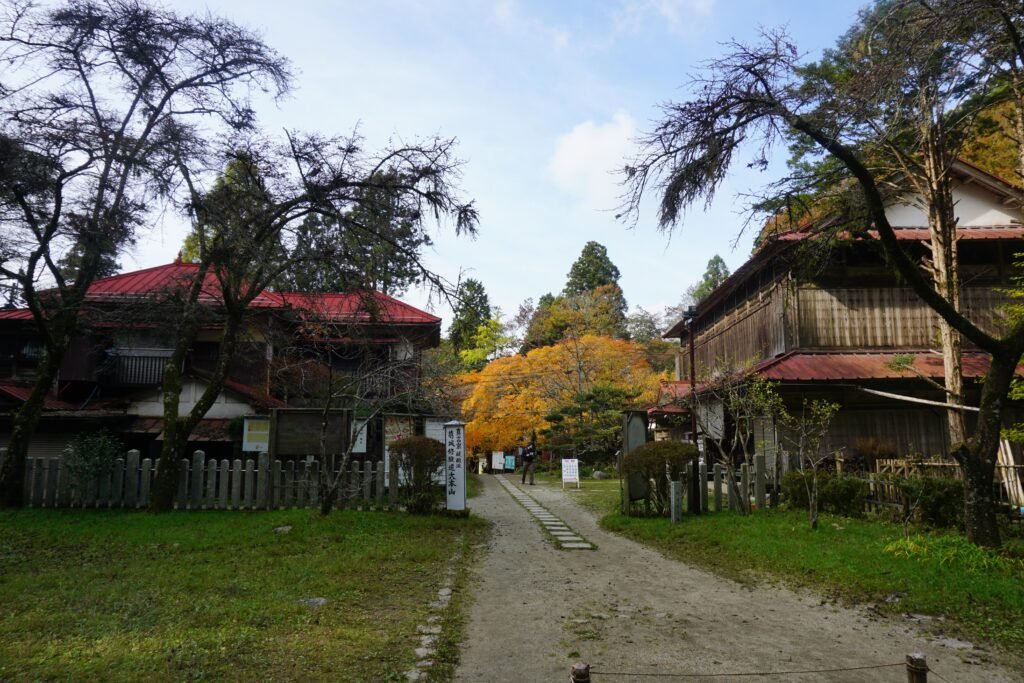
Tenporin-ji is thought to have been founded around the year 665 when a young En-no-Gyoja, founder of the mystical mountain religion Shugendo, was training on Kongo-san. The main hall of the temple sits above a small courtyard which has another impressive carving of O-Fudo-Myo-o-sama at its center. Many important priests trained at Temporin-ji during its history but the temple was all but abandoned in the late 19th century when Buddhism fell out of favor and Shugendo itself was outlawed. It wasn’t until after World War 2 that the temple came into use once again.
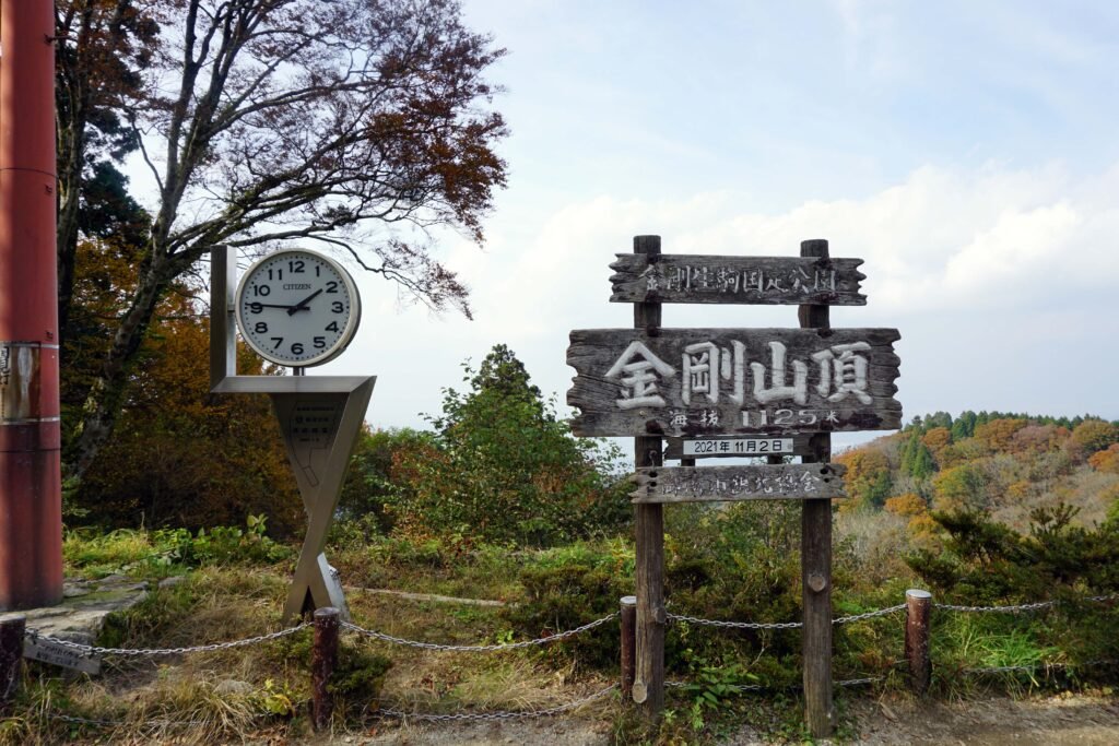
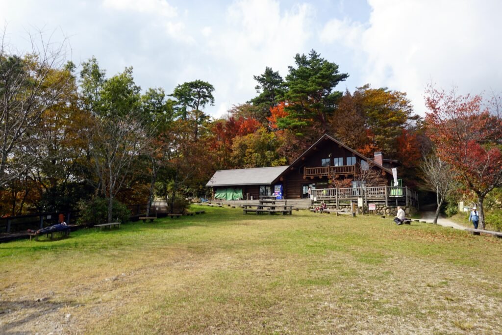
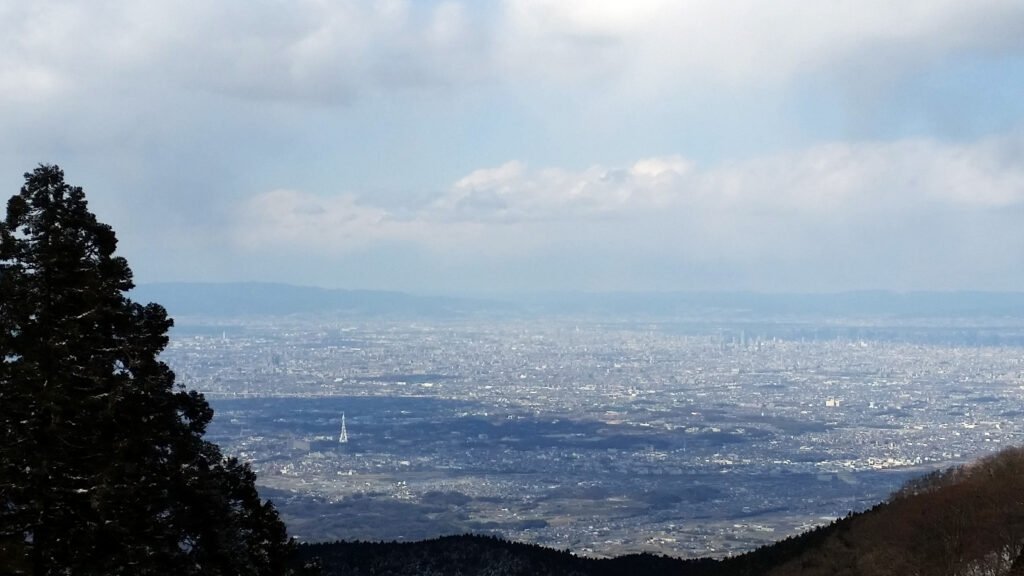
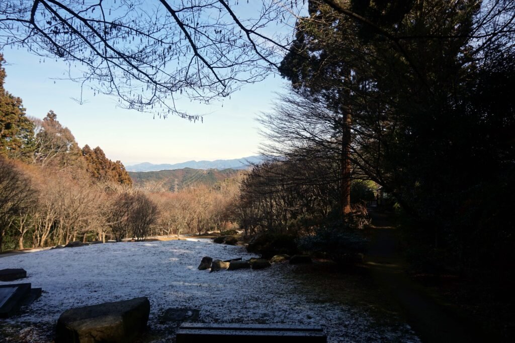
Off to the side of the temple courtyard is a building where you can purchase Omamori charms or Goshuin temple stamps. And beyond this is another rest area with a small café. In the depths of winter, snow is piled up next to the café along with a sign with that day’s date. Behind this, a short path opens out into a viewing area with a superb view out over Osaka Prefecture.
On clear days you can clearly pick out some of the larger landmarks of Osaka; the unusual white tower of Church of Perfect Liberty in Tondabayashi or the huge Abeno Harukas building. And when the weather is at its finest, you can see all the way across Osaka Bay to Kobe in Hyogo Prefecture and even the east coast of Shikoku. Winter time is when the views are at their most consistently good.
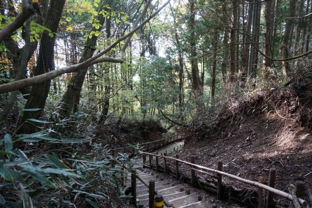
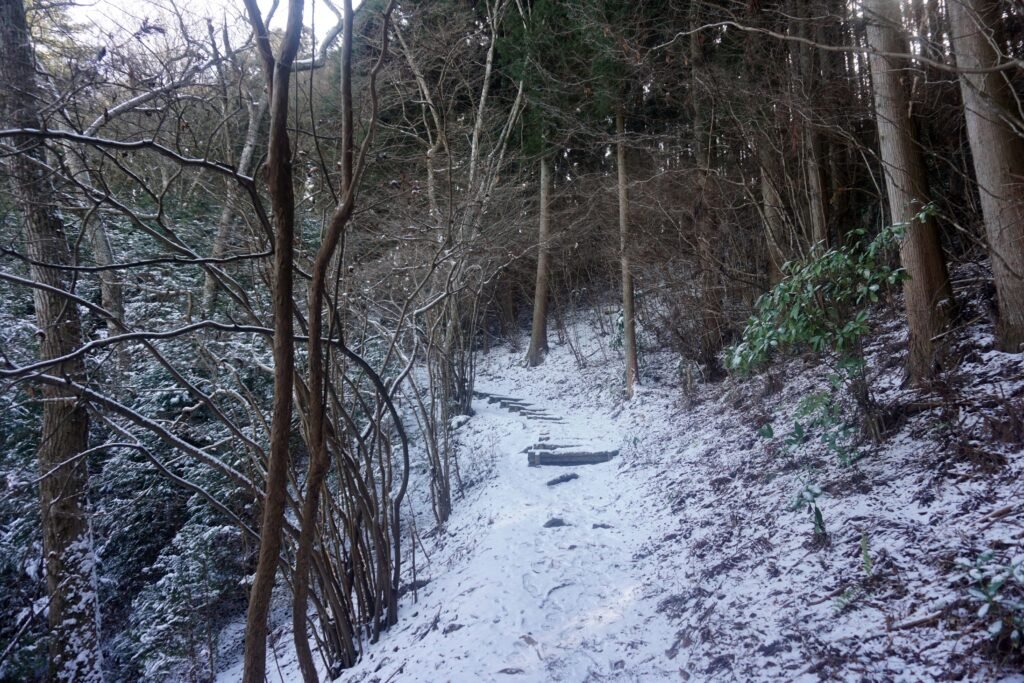
Opposite the café is an alternative hiking trail and one that I prefer when it comes time to descend the mountain. For the most part, this trail consists of steps cut from logs. This route is slightly shorter than the one I use to ascend but it also ends conveniently next to bus stops going back to Kawachinagano and Tondabayashi Stations. Along the way, you might occasionally spot small Jizo statues next to the path and even a small statue of Ultraman. Further down is an old, stone grave for Kusunoki Masanori who’s ancestor, Kusunoki Masashige, is integral to the history of the area.
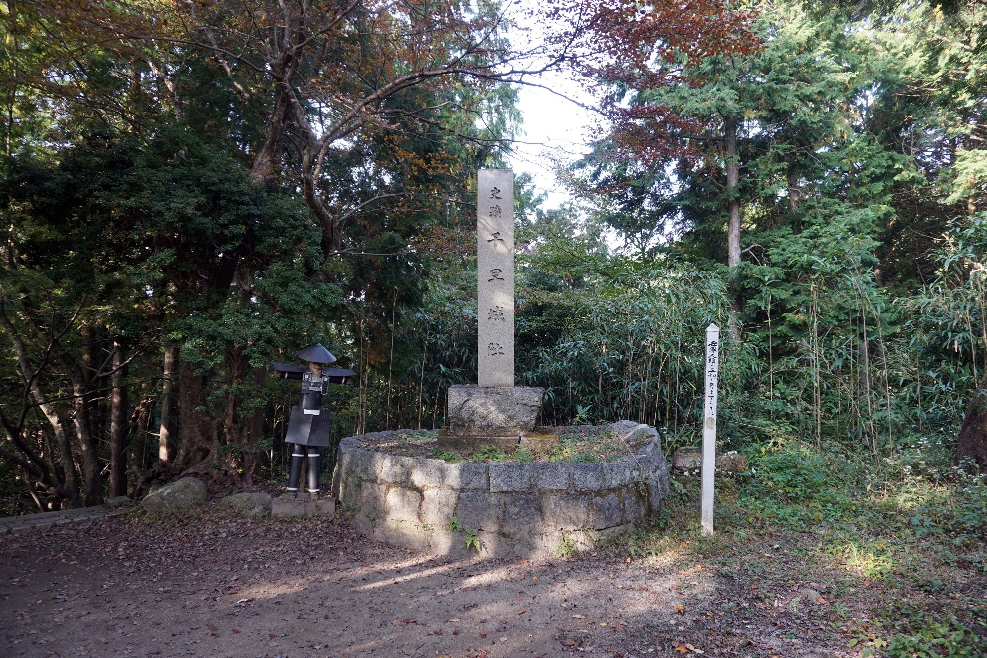
Not far from the end of the trail, another path branches off and leads you towards the site of Chihaya Castle. Although there are no discernable ruins, this castle is still on the list of the Top 100 Japanese Castles thanks to its history. It was build by the aforementioned Kusunoki Masashige in the 14th century during a tumultuous civil war period. At the time, the Emperor Go-Daigo was attempting to overthrow the Kamakura Shogunate and return power to the throne. Kusunoki Masashige was one of his top generals.
Following his defeat during the siege of nearby Akasaka Castle, Kusunoki had used what he had learned to make this fortification even more formidable. There were no huge stone walls, moats or towers like more modern castles; instead Chihaya castle was a mass of earthworks, palisades and deadly traps. These, coupled with the already inhospitable terrain, allowed Kusunoki to hold back and inflict severe casualties on a besieging Shogunate force. This prevented them from reinforcing other Shogunate armies elsewhere and allowed the capital at Kamakura to be captured.
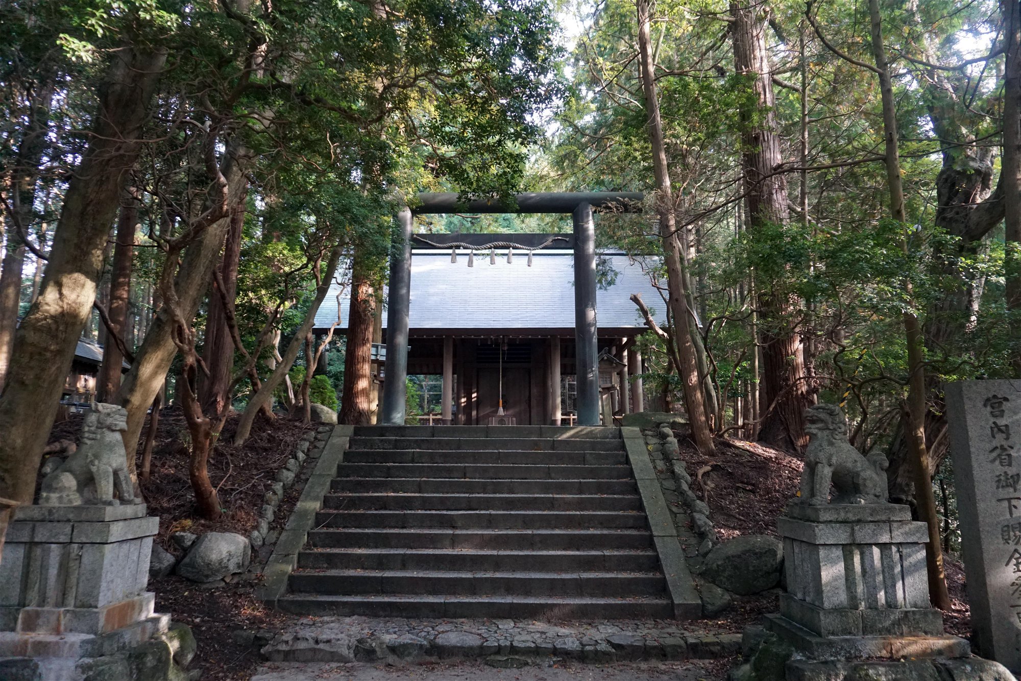
Although time seems to have wiped away any remnants of the castle, there is a stone monument bearing its name at Chihaya jinja, a shrine built roughly within the area that the castle occupied. This small shrine is always shrouded in shadow thanks to the tall trees that surround it. Close by though is a small clearing with what looks like a few empty buildings. Two stone lanterns at the far end of the clearing mark the path down, the rough stone steps taking you underneath a couple of torii and back to the bus stop.
Mount Iwawaki
At 897m, Iwawaki-san is the second highest mountain in the Kongo Range. This wide, flat topped peak is slightly harder to reach than Kongo-san but an equally popular climb. There is no public transport directly to this mountain so many people will drive or cycle to a point roughly halfway up before beginning to hike. Others will take a bus from Kawachinagano Station to Takihata Dam or a train to Amami Station or Kimitoge Station on the Nankai Koya Line and walk from there though these routes can be quite long.
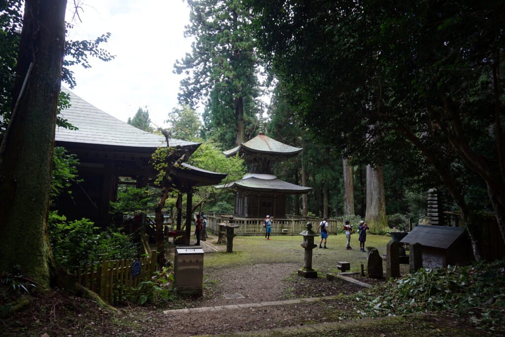
The trailhead is situated behind Iwawaki-dera, gloomy temple also said to have been founded by En-no-Gyoja between the years 701 and 704. Historically it was an important training center for Yamabushi who engaged in their difficult training within these mountains. The temple itself has a small main hall and pagoda which are dwarfed by the surrounding trees.
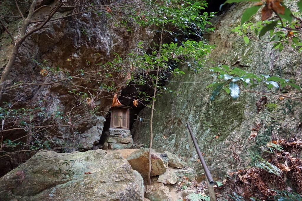
In the area around the temple are a handful of small waterfalls as well as a couple of smaller shrines. The most interesting and unusual of these is the Garyudo, a simple wooden altar hidden within a crevice in a cliff face a short walk from the temple.
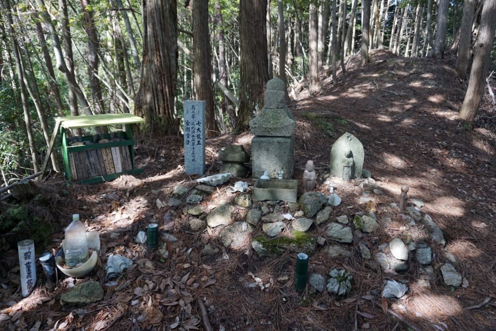
The trailhead begins a little further up the road behind Iwawaki-dera but if you continue up the road another 500m or so you might spot a tiny wooden sign directing you to a stupa mound on an outcrop overlooking the temple. This stupa mound is the 15th in a network of 28 similar power-spots scattered all across the Kongo-Ikoma-Kisen mountain range. They make up an ancient Shugendo training road called the Katsuragi 28 Shuku Kyozuka.
Back at the trailhead, it immediately splits in two. The right path is the most direct and leads you up a fairly steep path consisting mostly of wooden steps that ascend through the forest. While it isn’t the most interesting of climbs, it isn’t too difficult and only takes about an hour to reach the top of the mountain.
The left path is the “technical route”. It is a little more difficult, with more varied terrain and takes about 90 minutes to reach the top, but it is also a more interesting route. At times the path gets quite a little narrow or involves scrambling over the occasional boulder but there are also points that offer nice views out over Osaka Prefecture.
Both routes terminate on a wide forested ridge near the top of the mountain. The shorter route ends closer to the summit while the technical route ends further to the east along the Diamond Trail.
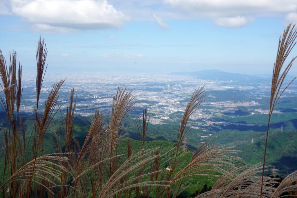
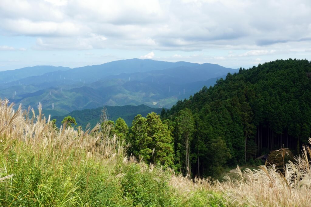
As you approach the summit, the trees open out into a wide space, which during fall is completely covered by pampas grass gently swaying in the wind. A single narrow path cuts through the grass to the summit proper. Beyond the pampas grass, the view is impressive. Just like Kongo-san, you can see the whole of the prefecture below but with fewer trees at the top of Iwawaki-san, you also get a good view of the surrounding mountains.
There are a few routes that you can take to get back down from the summit. The quickest is to go back the same way, down either the fast or technical route to Iwawaki-dera. Alternatively, you can follow the Diamond Trail east towards Kimitoge and descend either the southern side of the trail to Kimitoge Station or the northern side to Amami Station.
Katsuragi
Historically, this whole range, stretching from the Wakayama coast to the point where the Yamato River crosses from Nara Prefecture into Osaka, was known as Katsuragi. It was also the first training ground for En-no-Gyoja as he was developing the practices that would go on to become Shugendo.
The name Katsuragi has remained connected to the area down through the centuries with several mountains still bearing it. Yamato-Katsuragi-san is a mountain on the Osaka/Nara border close to the birthplace of En-no-Gyoja himself. Minami-Katsuragi-san sits just behind Mount Iwawaki and further to the west, Izumi-Katsuragi-san is covered in a primordial forest of beech trees.
And Katsuragi-Shugen, the oldest form of Shugendo, is still practised deep within these mountains as yamabushi walk the trails to visit the stupa mounds of the Katsuragi 28 Shuku Kyozuka pilgrimage and the multitude of mysterious and powerful places in between.
Access
To reach Mount Kongo, take the Nankai Koya Line from Nankai Namba Station to Kawachinagano Station then take a bus bound for “Mount Kongo Ropeway”. Alternatively take the Kintetsu Line from Osaka Abenobashi Station to either Tondabayashi Station or Kawachinagano Station and again take the “Mount Kongo Ropeway” bus.
For Mount Iwawaki take Nankai Koya Line to Kawachinagano Station and then take the bus to Takihata Dam. One of the main trailheads begins near the public toilets. You can also take the Nankai Koya Line to Amami Station or Kimitoge Station and walk/hike from either of these. However, it is most convenient to drive to Mount Iwawaki and park in one of the public car parks on the road leading up to the temple.

- Social History of Osaka")


