


Exploring unknown rural parts of Osaka is a particular passion of mine and often these places are literally so far off the beaten track that there is almost no track at all. Often I spend time wandering somewhere along the mountainous border between Osaka, Wakayama and Nara Prefectures, in between the mountains of Kongo-san and Iwawaki-san.
But one of my favourite places for this kind of exploration is the isolated area sandwiched between the regions of Amami, Iwaze and Ishimigawa in the south east corner of the city of Kawachinagano. This is itself in the far south east corner of Osaka Prefecture. This heavily forested place contains a maze of narrow roads that once connected small farming plots, now hardly used.
Branching off of these roads are equally unused hiking trails that connect a handful of small mountains that even many local people are unaware of. Fuchoyama, Tayama, Hataodake and Iwaze-Kyozukayama are just a few of the mountains scattered either side of a slender, dark valley called Sai-no-Kami-dani.
But this region is more than just a collection of old farm tracks and hiking trails; it is also a place of spiritual and historical significance as it forms part of an ancient pilgrimage trail that dates all the way back to the founding of the mysterious folk religion of Shugendo.
Entering the Woods
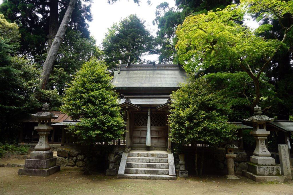
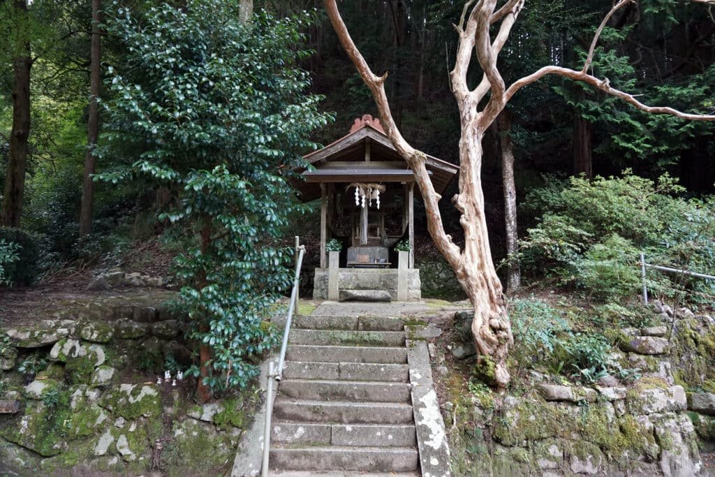
My preferred route into Iwaze starts from Amami Station on the Nankai Koya Line then heading south along the footpath that runs alongside the railway line. Eventually the path turns east uphill passed a small shrine called Kanii jinja. This shrine is dedicated to Jimmu Tenno, the legendary first emperor of Japan and is said to mark one of the locations he camped with his army as he was embarking on his conquest of Yamato.
After his initial defeat when trying to invade what is now Nara Prefecture through the mountains of northern Osaka, Emperor Jimmu retreated south through Osaka and briefly camped on or near this hillside. He then marched his army west towards the coast before heading by boat to the tip of Wakayama Prefecture far to the south.
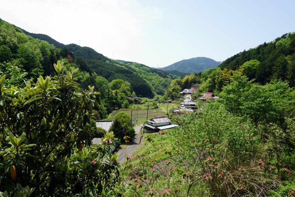
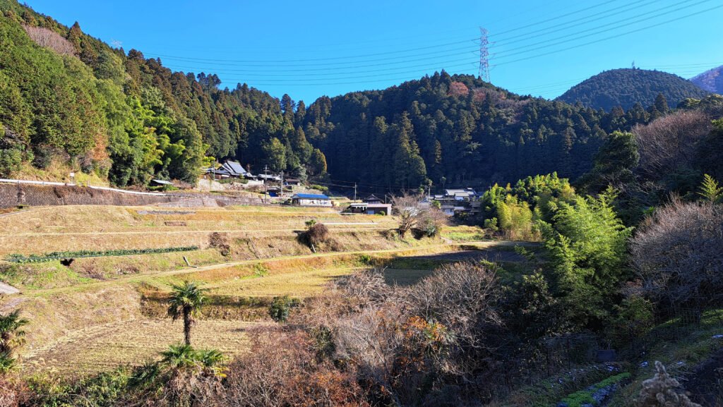
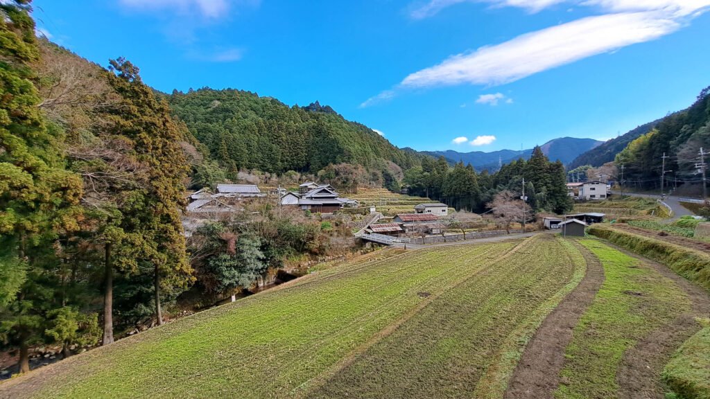
The little lane that runs passed the shrine is known as the “Hinoki Slope” and there are local legends of mischievous tanuki spirits that live in the area and play tricks on unsuspecting travelers. It winds up into Shima-no-tani, a picturesque farming village set in a valley right on the Osaka / Wakayama border. Large houses flank both sides of the valley and in the center are numerous fields for growing rice and vegetables. Surprisingly for such a small and out of the way village, the number of abandoned houses is actually very low.
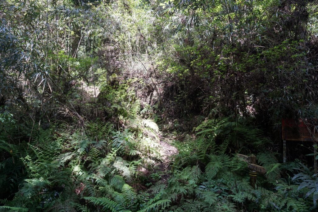
At the top of the village, the road morphs into a rough track and disappears into the trees. This narrow path is an access point to the dark forest and network of trails and back-roads sandwiched between the villages of Shima-no-tani, Amami, Oi, Kobuka and Ishimigawa that make up the most south-easterly part of Osaka Prefecture.
Table of Contents
Fuchoyama
The road climbs steadily upwards and after about 15 minutes, you may just spot a small sign labelled Jujitoge pointing at a tiny, overgrown hiking trail that looks barely traversable. Steep and narrow, it takes another 10 minutes to scramble up before it finally opens out at Jujitoge, a junction of several mountain roads and trails.
To the right, a road labelled Tanboyama eventually turns south and connects to the Diamond Trail, a long hiking trail running along the borders of Osaka, Wakayama and Nara Prefectures. Two roads immediately below Jujitoge take you to the far eastern side of Iwaze and the villages of Ishimigawa and Kobuka. The road to the left leads to the first of the mountains, Fuchoyama, though you do need to keep an eye out for another tiny path on the left side of the track and follow that instead as the obvious main path ends rather abruptly.
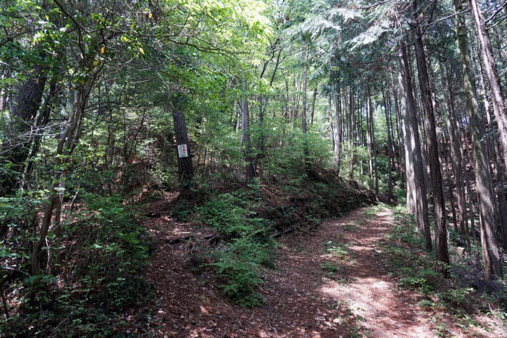
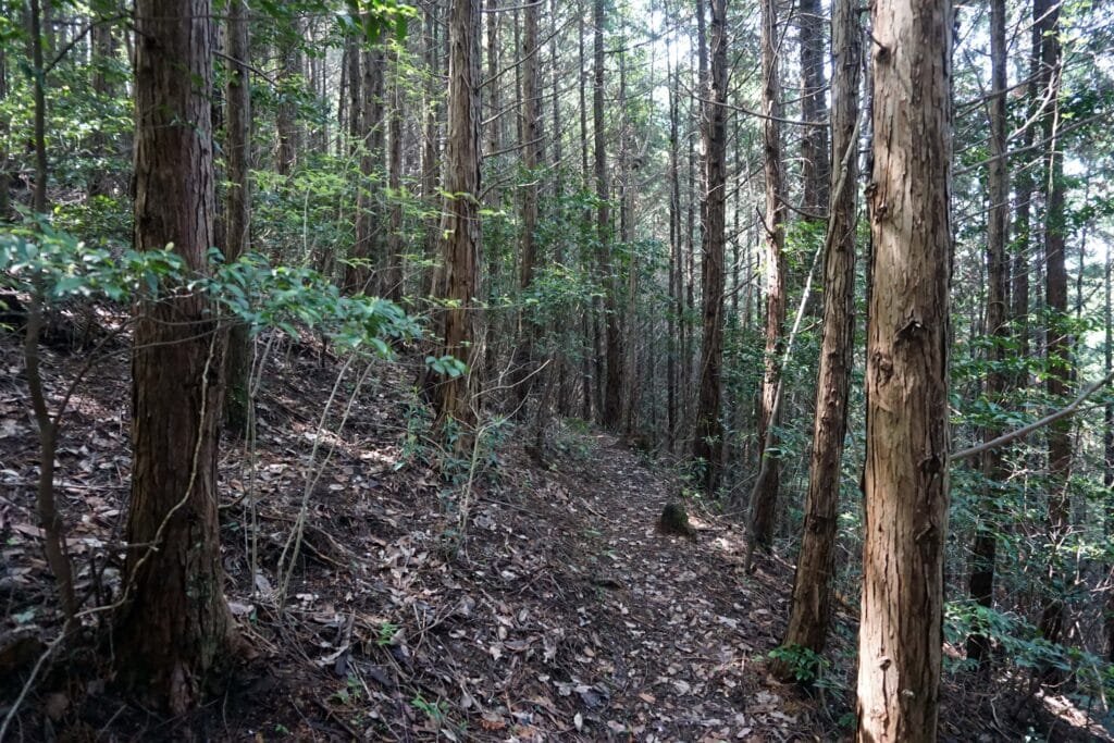
Although slightly steep in places and with signs being small, few and far between, the path is not particularly difficult. The foliage to either side can be quite dense and this, coupled with the scarcity of visitors mean that the trail is often full of barely visible spider webs. It is nonetheless an enjoyable hike because the terrain and the narrowness of the paths enhance the feeling of isolation. It makes it quite exciting, especially when on your own.
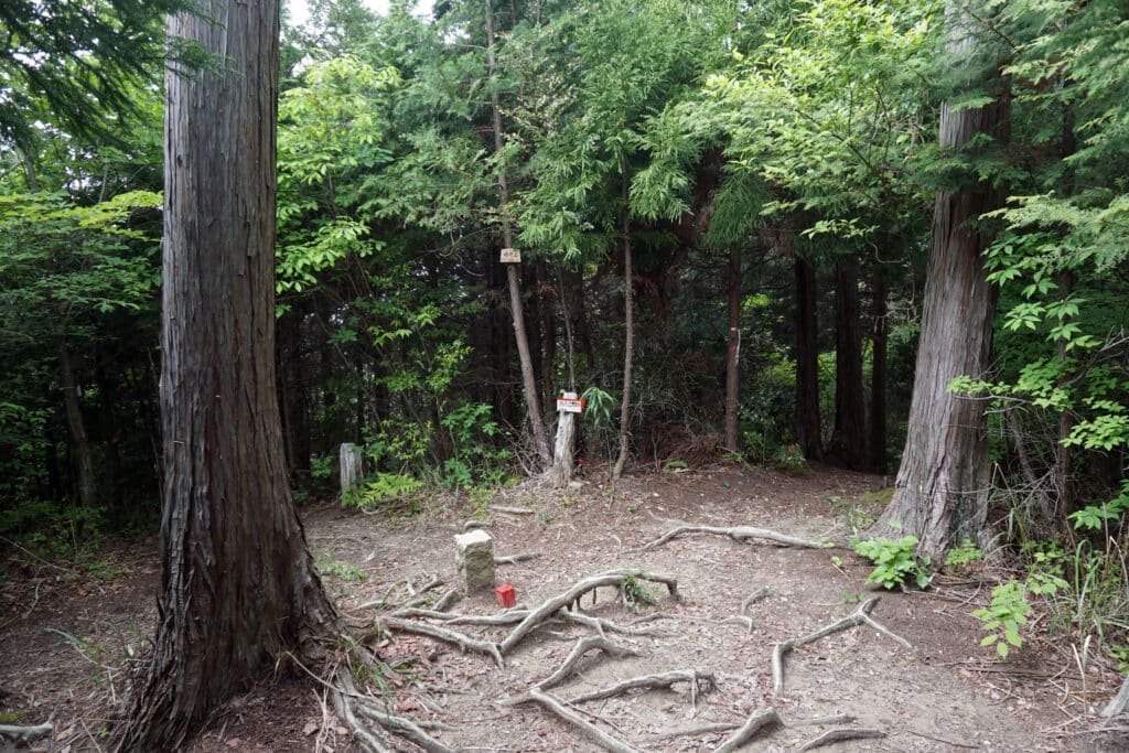
Eventually the path opens out into a small clearing, barely 5 metres squared, with a small stone marker at its center. This is the summit of Fuchoyama, though with no panoramic views, you don’t really get the sense of being at the top of a 610m mountain. It does however act as another crossroads and gateway to the further reaches of Iwaze. It sits right at the southern tip of the Sai-no-Kami valley and here the trail splits in two. Taking the right path leads you along the eastern edge of the valley towards Tayama and the left path follows the western edge towards Hataodake and Iwaze-Kyozuka-yama.
Iwaze-Kyozukayama
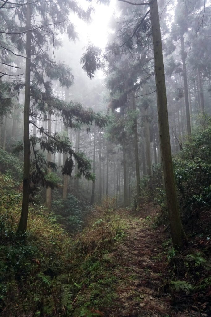
From Fuchoyama, my favourite route is to take the left path that leads to Hataodake. As before, the trail is not especially difficult and you can walk it at a relaxed pace. Similar to the path up to Fuchoyama, there are few breaks in the trees allowing you to see out across the region of Amami.
Despite being at times being only about 1 or 2 kilometres from the relatively busy railway line to Koyasan, it is easy to feel like you are in the middle of nowhere. The track and the villages along it are completely invisible, hidden between the curves of the hills.
Hataodake itself is known as the Fuji-san of Amami as its shape is supposed to be similar to that of Japan’s most famous mountain. The important 14th century samurai, Kusunoki Masashige, was also supposed to have had a secret military camp on the mountain from where he could harass the forces of the Kamakura Shogunate. In fact he won quite a spectacular victory in a battle that took place nearby in Amami against a force that vastly outnumbered his.
I am not sure if I have ever found the summit of Hataodake specifically though. There is one well-worn stone marker along the trail that I cannot read well but I have never seen a sign-board for it. All the other trails I’ve found for it, except for this one, have been in such poor condition that I had to turn back.
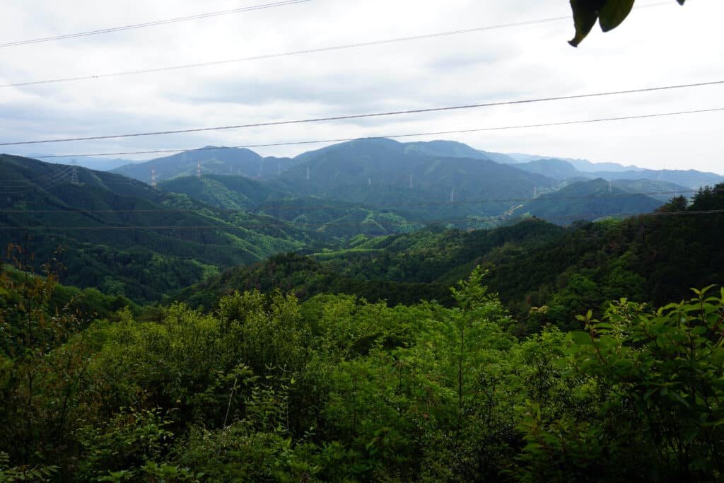
However; there is an unmarked path that runs from the stone marker to a gap in the trees wide enough to get quite a lovely view (powerlines notwithstanding) across to the opposite side of Amami to the village of Nagaretani. This village also has a powerful connection to Shugendo and may also have at one point been a Hidden Christian enclave back when Christianity was outlawed in Japan.
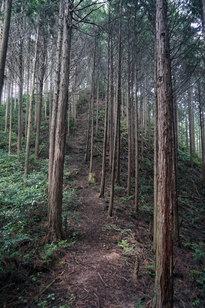
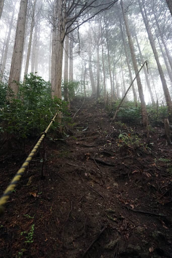
Continuing along the main path for a short distance, it curves sharply to the right and descends quite steeply onto a kind of ridge surrounded by tall, slender and closely packed trees. Walking straight along it, you very quickly reach a path so steep that you need to use the rope tied to the trees to pull yourself up. Although only about 30m, it can be very slippery, especially after recent rainfall. This tiny mountain is Iwaze-Kyozukayama and has important spiritual significance since it is the location of Iwaze-Kyozukayama Zuiki Kudo-kuhon. This pair of large flat stones mark the location of a power spot along an ancient Shugendo pilgrimage.
Shugendo is an ancient Japanese religion based around worship of, and on, mountains. It merges elements of Shinto, Buddhism and many local customs and traditions. Shugendo means “The path of training and testing” and the Shugenja or Yamabushi who practice it undergo difficult trials within the mountains across much of Japan to find enlightenment and supernatural powers called Genriki.
It was founded in the 8th century by En-no-Gyoja, a semi-legendary mystic who was born near Mount Yamato-Katsuragi in what is now Gose, Nara Prefecture. He first began practising what would be the basis of Shugendo in the Katsuragi Mountains, a collective name for the Izumi Range which runs along the Osaka/Wakayama border and the Kongo Range along the Osaka/Nara border.
This small monument is the 18th of 28 similar monuments spread out along the borders between Osaka, Wakayama and Nara Prefectures. It is said to follow the route that En-no-Gyoja walked through these mountains when he was first developing the concept of Shugendo. Over time it evolved into a pilgrimage called the Katsuragi 28 Shuku Kyozuka.
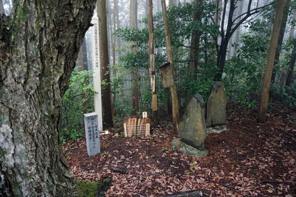
At certain points on his journey, he would stop and bury a chapter of the Lotus Sutra and each of the 28 monuments along the pilgrimage corresponds to one of the 28 chapters of the Sutra. One of the two stones marks the location of the 18th chapter of the Lotus Sutra and the other commemorates past Shugendo masters.
It is still visited several times a year by Yamabushi. To mark their visit they might leave a “hide”, a small wooden, handwritten prayer tablet similar to the “ema” prayer tablets you find hanging at shrines. On it they write their name, the date, the temple or branch of Shugendo they associate with and their prayer. Unlike the ema at shrines, these hide are very rarely removed and sometimes you can find some that are many years old.
Out of the Valley
Once finished at the stupa mound, it’s time to descend carefully back down the same steep slope back onto the ridge. Rather than retracing your steps back up the other side, you can instead turn left and take a short path down between the trees. This quickly brings you to a narrow and mostly dry creek bed which you can follow through a break in the trees, back to almost daylight.
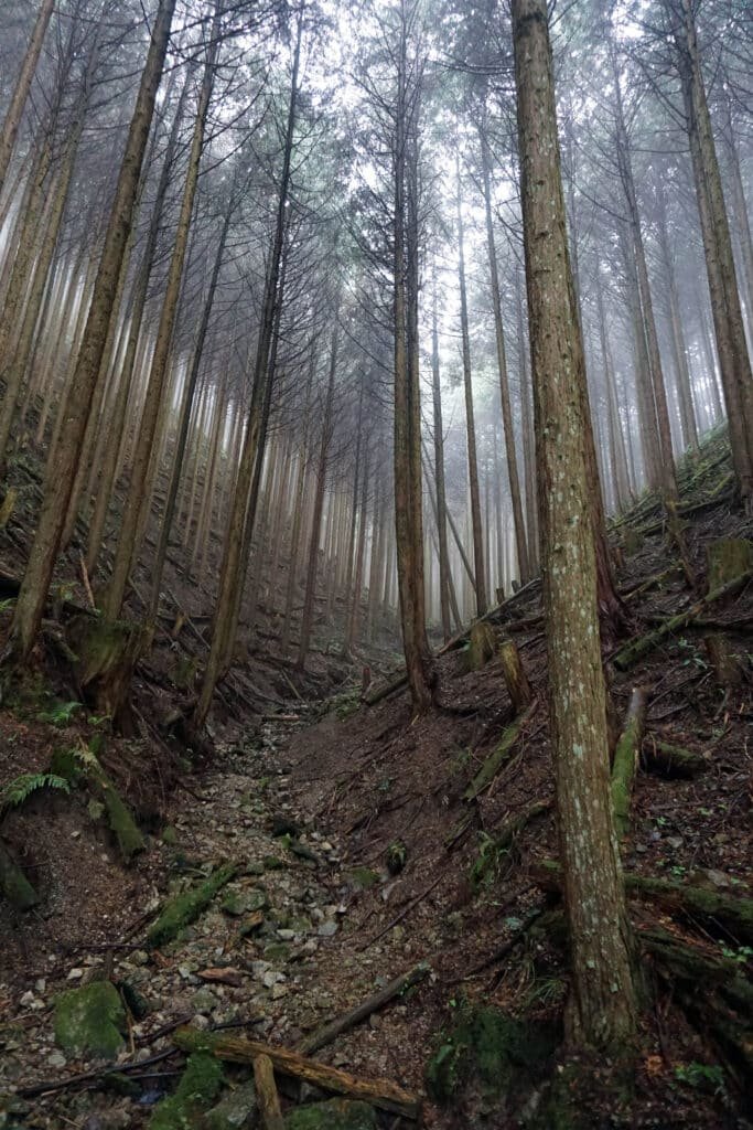
From here, the final leg of the journey is down a roughly concreted track mostly used by a handful of local farmers. It runs along the bottom of Sai-no-Kami valley following a small river. In my experience, the best time to explore here is during or just after rain. This hidden little valley fills with a thick mist, creating a truly magical and mysterious atmosphere.
There are a couple of curiosities among the trees as you wander down the road. Carefully stacked logs built onto several terraces on the hillside form a large Shiitake mushroom farm. And right on the edge of the woods is a tiny, empty house. Most unusual though is what looks like an abandoned al-fresco dining area built from timber and overlooking the river.
As you exit the woods at last, the road passes a couple of small fields and then curves around to the left. Set within the bank as you round the corner are a pair of unusual little shrines. These very roughly built stone altars each contain a tiny torii gate and are the Sai-no-Kami that give the valley beyond its name. These shrines contain the spirits which protect the valley and also serve to draw in and absorb evil spirits from the surrounding woodland.
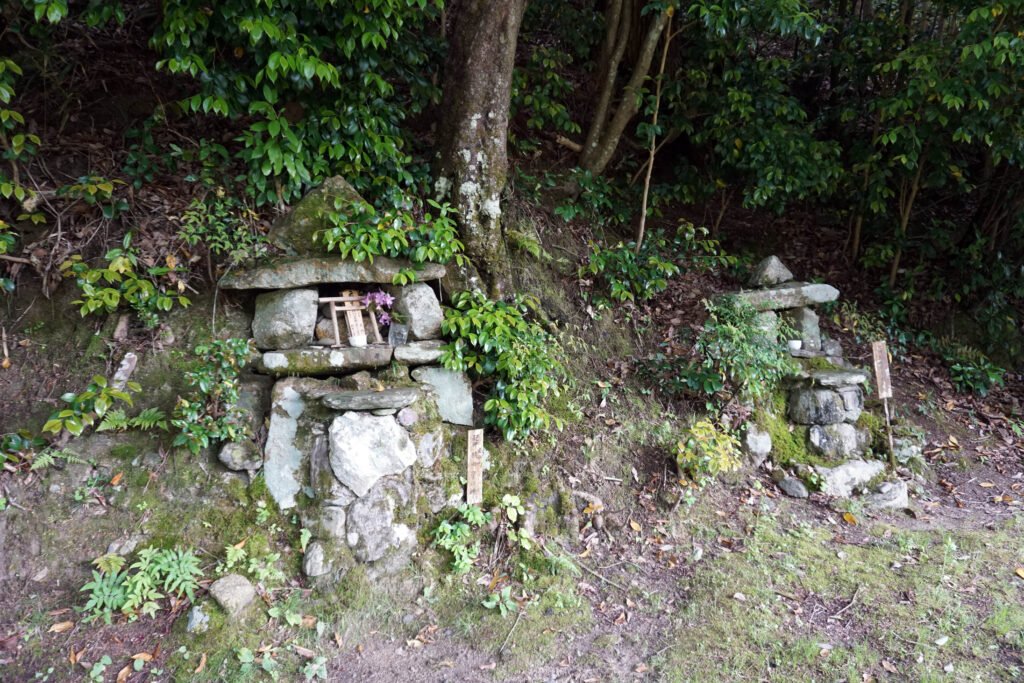
Opposite the shrines, and surrounded by a few more small fields, what looks like a house is actually a rather nice cafe called “Poem”. They serve light meals made from locally grown ingredients though they are closed on Mondays.
From Cafe Poem it is just a straight 5 minute walk down to Chihayaguchi Station on the Nankai Koya Line giving easy access back to Namba in downtown Osaka. There is also a walking and cycle path which runs parallel to the railway line south back towards Amami Station and north towards Mikanodai Station.
Tayama and the Far Reaches
Now lets jump back to Fuchoyama and this time take the right hand path to Tayama. The trail is relatively flat for the most part as it meanders roughly north along the right side of Sai-no-Kami-Dani. The going is once again quite easy making it ideal for a slow walk to appreciate the surrounding forest.
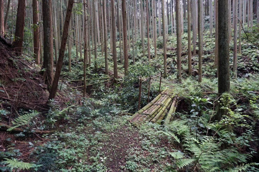
Eventually the route descends sharply down a winding road but with no signs it can be difficult to determine your exact location. As the gradient flattens again, the rough road continues north but in many places, intriguing little side paths branch off. One of these little paths in particular leads across a couple of slippery log bridges, curls around west and finally comes to an end just a few hundred metres from the exit to Sai-no-Kami-dani.
Most of the routes though head north east through the woods towards a collection of rustic villages along the the Ishimi River. The furthest village, Ishimigawa, is right on the border of Osaka and Nara Prefectures. Then as you follow the river down along Highway 310, it leads you through picturesque Kobuka and Oi.
Both Kobuka and Oi have their own connection to Shugendo, showing just how important its presence was to small, rural communities. In Kobuka, a small shrine called the “Tengu-do”, or Tengu Hall, sits at the base of an almost conical hill. This suggests that the hill is home to a Tengu, the supernatural creatures often depicted with long noses and bright red faces. Tengu are often connected to Shugendo and can be seen to wear the same white robes as Yamabushi. Kobuka is also a junction that gives access to nearby Mount Kongo, one of the most important Shugendo locations in Kansai.
Further down the road in Oi, a small shrine sits right next to the village bus stop and within that are a pair of small statues. The left carving is O-Jizo-sama, seen all over Japan at the side of roads in his role as protector of travellers. He is one of the most easily recognised statues as he often sports a bright red hat though here he wears a red bib instead.
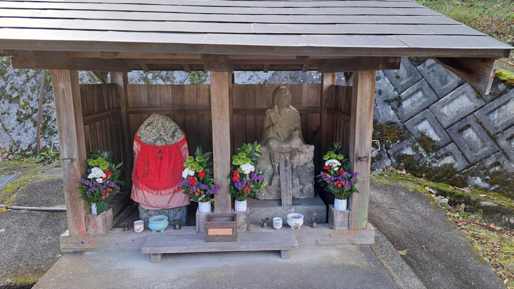
The statue on the right of the bearded man holding a scroll is En-no-Gyoja, the semi-legendary wandering monk and founder of Shugendo as well as a number of temples throughout southern Osaka.
Osawa Kaido and Kanshin-ji
Just beyond Oi, another road breaks off to your left towards the village of Hatohara. Here you can access a particularly quiet section of the Osawa Kaido, an old trading road connecting southern Osaka to the town of Gojo in central Nara. This narrow road offers a safe and pleasant alternative to the relatively busy Highway 310; used only by a handful of farmers to access clusters of terraced farmland.
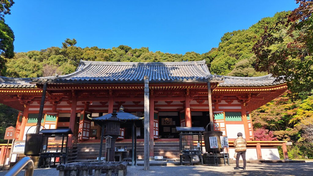
The narrow, gloomy lane wends its way north west and eventually rejoins Highway 310 just across the road from Kanshin-ji, one of the most important temples in Kawachinagano. Originally founded by En-no-Gyoja, it was later renovated by Kukai, the founder of Shingon Buddhism and of the mountain retreat of Koyasan.
Then during the 14th century, it was renovated once again by an influential local samurai called Kusunoki Masashige who was educated here and whose statue sits on the wall near the temple gate. After his heroic death at the Battle of Minatogawa, Kusunoki’s head was cut off and returned to Kanshin-ji for burial in a small grave in a corner of the temple grounds. A flight of stone steps at the back of the temple lead up to a much larger mausoleum, that of 14th century Emperor Go-Murakami.
The main hall of Kanshin-ji, as well as its statue of Kannon, Goddess of Mercy, are both considered national treasures. The grounds of the temple also contain a Gyoja-do, a hall containing a statue of En-no-Gyoja. This statue is particularly impressive though you do need to find someone to ask permission before opening the doors to view it.
Although it is possible to keep walking all the way down Highway 310 to either Mikkaichicho or Kawachinagano Stations, it is much easier to finish the long walk at the nearby bus stop and get the bus back down to Kawachinagano Station to meet your train back to downtown Osaka.
Few people realize that there are some amazing things hidden in the woods if you just know where to look.

- Social History of Osaka")


Fantastic Article!
David your articles are fascinating! Thank you for sharing them with us in Jackson California! Love you us!!
Hi Marilyn (Mom!) thanks much. This particular article above on the outback and trails was written by fellow writer, and KawachiNagano resident, Gary Luscombe! An avid hiker and outdoorsman. Indeed a great read! Glad you enjoyed it!